proland::WaterElevationLayer::WaterElevationCurveData Class Reference
An ElevationCurveData for river elevation profiles. More...
#include <WaterElevationLayer.h>
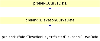
Inheritance diagram for proland::WaterElevationLayer::WaterElevationCurveData:

Public Types | |
| enum | riverType { BORDER = -2, OBSTACLE = -1, RIVER = 0, ISLAND = 1, LAKE = 2 } |
Predefined types for rivers. More... | |
Public Member Functions | |
| WaterElevationCurveData (CurveId id, CurvePtr flattenCurve, ptr< TileProducer > elevations) | |
| Creates a new RoadElevationCurveData. | |
| ~WaterElevationCurveData () | |
| Deletes this WaterElevationCurveData. | |
| virtual float | getAltitude (float s) |
| Returns the height corresponding to the given s coordinate. | |
| virtual float | getSampleLength (CurvePtr c) |
| Returns the distance to be used between samples for the elevation profile of the given curve. | |
Protected Member Functions | |
| virtual float | getCapLength (NodePtr p, vec2d q) |
| Computes the cap length at a given extremity. | |
Detailed Description
An ElevationCurveData for river elevation profiles.
Member Enumeration Documentation
Predefined types for rivers.
Used for drawing and managing rivers.
Constructor & Destructor Documentation
| proland::WaterElevationLayer::WaterElevationCurveData::WaterElevationCurveData | ( | CurveId | id, | |
| CurvePtr | flattenCurve, | |||
| ptr< TileProducer > | elevations | |||
| ) |
Creates a new RoadElevationCurveData.
- Parameters:
-
id the id of the curve for which we need to store the data. flattenCurve the flattened version of the curve for which we need to store the data. elevations the producer used to compute raw terrain elevations, themselves used to compute the elevation profile.
| proland::WaterElevationLayer::WaterElevationCurveData::~WaterElevationCurveData | ( | ) |
Deletes this WaterElevationCurveData.
Member Function Documentation
| virtual float proland::WaterElevationLayer::WaterElevationCurveData::getAltitude | ( | float | s | ) | [virtual] |
Returns the height corresponding to the given s coordinate.
- Parameters:
-
s a pseudo curvilinear coordinate (see Curve::Vertex::s).
Reimplemented from proland::ElevationCurveData.
| virtual float proland::WaterElevationLayer::WaterElevationCurveData::getCapLength | ( | NodePtr | p, | |
| vec2d | q | |||
| ) | [protected, virtual] |
Computes the cap length at a given extremity.
- Parameters:
-
p the Node from which to compute the cap length. q a point determining the direction of the cap length. path the Curve to compute the cap length from. Must contain p & q.
Reimplemented from proland::CurveData.
| virtual float proland::WaterElevationLayer::WaterElevationCurveData::getSampleLength | ( | CurvePtr | c | ) | [virtual] |
Returns the distance to be used between samples for the elevation profile of the given curve.
This distance depends on the curve's width (so that wider curves have a smoother profile).
- Parameters:
-
c a curve.
Reimplemented from proland::ElevationCurveData.
 1.6.1
1.6.1